Quick Scroll To:
DESCRIPTION
There has been a need for databases that are geo-typical
rather than geo-specific; that is, they do not represent any place in particular.
The motivation is to create politically neutral geography for large area
war-gaming.
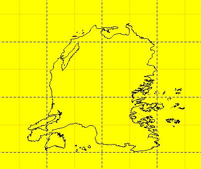
This transmittal represents a fictitious continent
in the northeast Atlantic Ocean -- one of four large geo-typical data sets
created by SAIC Chantilly for the DTRA Synthetic Exercise Environments
Program.
.
 _
_
_
_ 
.
Areas within the Atlantis database were intensified
and augmented with fictitious feature data under DARPA�s Advanced Simulation
Technology Thrust (ASTT). For this data set, we selected a 144 km by 100
km section of Atlantis.
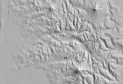
The STF contains geotypical open terrain, consisting
of pseudo DTED Level 1 terrain data and pseudo VMAP Level 1 feature data.
Both gridded and polygonal data sets are provided
in the download.
DATA CONTENT
.
Gridded Data
AUTM Database Extents:
- Lower left corner: (425404.875, 5316300.50)
- Upper right corner: (578324.75, 5433545.00)
- Minimum elevation value: 0.00 (meters)
- Maximum elevation value: 0.00 (meters)
DRM Classes Used:
- AUTM Location 3D
- Absolute Time Interval
- Absolute Time Point
- Access
- Areal Feature
- Citation
- Classification Data
- Classification Related Features
- Connected Feature Edge
- Data Quality
- Description
- Environment Root
- Environmental Domain Summary
- External Feature Face Ring
- Feature Edge
- Feature Node
- Internal Feature Face Ring
- Keywords
- Linear Feature
|
- Perimeter Data
- Perimeter Related Feature Topology
- Point Feature
- Point Of Contact
- Process
- Property Grid
- Property Grid Hook Point
- Property Value
- Regular Axis
- Regular Feature Face
- Spatial Domain
- Table Property Description
- Transmittal Root
- Transmittal Summary
- Union Of Feature Topology
- Union Of Features
- Union Of Geometry Hierarchy
- Universal Feature Face
- .
|
EDCS Classification Codes Present:
- ECC_AERODROME
- ECC_BRIDGE
- ECC_COMMUNICATION_TOWER
- ECC_CONTROL_TOWER
- ECC_DISH_ANTENNA
- ECC_GRASS_LAND
- ECC_LAND
- ECC_OBJECT
- ECC_PUMPING_STATION
- ECC_SPOT_ELEVATION
- ECC_TREED_TRACT
- ECC_TUNDRA
.
Polygonal Data
Polygons: 737686
Area: 14400 km2
AUTM Database Extents:
- Lower left corner: (426000.00, 5317000.00)
- Upper right corner: (570000.00, 5417000.00)
- Minimum elevation value: 0.00 (meters)
- Maximum elevation value: 4106.29004 (meters)
DRM Classes Used:
- AUTM Location 3D
- Absolute Time Interval
- Absolute Time Point
- Access
- Ambient Colour
- Areal Feature
- Attribute Set
- Attribute Set Index
- Attribute Set Table
- Attribute Set Table Group
- Attribute Set Table Library
- Citation
- Classification Data
- Classification Related Features
- Classification Related Geometry
- Colour Shininess
- Connected Feature Edge
- Data Quality
- Description
- Diffuse Colour
- Distance Level Of Detail Data
- Emissive Colour
- Environment Root
- Environmental Domain Summary
- External Feature Face Ring
- Feature Edge
- Feature Node
- Geometry Model
- Geometry Model Instance
- Image
- Image Library
- Image Mapping Function
- Inline Colour
- Internal Feature Face Ring
- Keywords
|
- LSR Location 3D
- Level Of Detail Related Geometry
- Linear Feature
- Model
- Model Library
- Perimeter Data
- Perimeter Related Feature Topology
- Point Feature
- Point Of Contact
- Polygon
- Presentation Domain
- Primitive Colour
- Process
- Property Value
- RGB Colour
- Reference Vector
- Regular Feature Face
- Rendering Properties
- Spatial Domain
- Spatial Index Data
- Spatial Index Related Geometry
- Specular Colour
- Texture Coordinate
- Translucency
- Transmittal Root
- Transmittal Summary
- Union Of Feature Topology
- Union Of Features
- Union Of Geometry Hierarchy
- Union Of Primitive Geometry
- Universal Feature Face
- Vertex
- World 3x3
- World Transformation
- .
|
EDCS Classification Codes Present:
- ECC_ANTENNA
- ECC_BUILDING
- ECC_COMMUNICATION_TOWER
- ECC_LAND
- ECC_NON_COMMUNICATION_TOWER
COMPATIBILITY INFORMATION
This data set is compliant with SEDRIS 3.1.x.
POINT OF CONTACT
Send email to [email protected] / [email protected] for questions or assistance in using this data
set.
As a minimum, please provide the following in your
email:
- data set name
- SEDRIS compatibility version
- hardware architecture
- OS name and version
- detailed problem description
DOWNLOAD
- FILE
|
- SIZE
|
- atlantis_3.1.zip
|
- 73.5M
|
|
Last updated:
_ January 28, 2004
|