|
Fact Sheet: _
MCB Camp Pendleton, California,
USA
|
Quick Scroll To:
DESCRIPTION
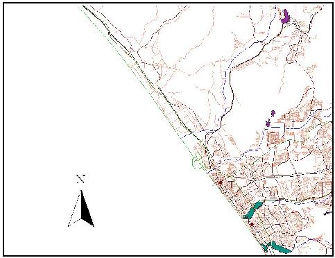
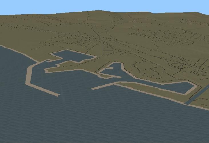
This transmittal is a moderate-resolution terrain
data base contained within the spatial extent of the low-resolution Oceanside
terrain data base. The Marine Corps Base (MCB) Camp Pendleton data set
draws on the same 25-meter grid composite surface as the Oceanside terrain
data base.
.
 _
_
_
_ 
.
Feature data is derived from a GIS data set maintained
by the San Diego Association
of Governments (go to �Resources�, then �Maps and GIS�). In addition
to incorporating feature data, the integrated TIN terrain data base has
been compiled at a much higher polygonal density.
Various examples of oceanpgraphic and metereological
data for this area are available from the Master
Environmental Library (MEL), including data from Kernel Blitz 2001.
Both gridded and polygonal data sets are provided
in the download.
DATA CONTENT
.
Gridded Data
AUTM Database Extents:
- Lower left corner: (444589.59375, 3637528.50)
- Upper right corner: (492063.46875, 3699192.50)
- Minimum elevation value: 0.00 (meters)
- Maximum elevation value: 0.00 (meters)
DRM Classes Used:
- AUTM Location 3D
- Absolute Time Interval
- Absolute Time Point
- Access
- Areal Feature
- Citation
- Classification Data
- Classification Related Features
- Connected Feature Edge
- Data Quality
- Description
- Environment Root
- Environmental Domain Summary
- External Feature Face Ring
- Feature Edge
- Feature Node
- Internal Feature Face Ring
- Keywords
|
- Linear Feature
- Perimeter Data
- Perimeter Related Feature Topology
- Point Feature
- Point Of Contact
- Process
- Property Grid
- Property Grid Hook Point
- Regular Axis
- Regular Feature Face
- Spatial Domain
- Table Property Description
- Transmittal Root
- Transmittal Summary
- Union Of Feature Topology
- Union Of Features
- Union Of Geometry Hierarchy
- Universal Feature Face
|
EDCS Classification Codes Present:
- ECC_LAND
- ECC_OBJECT
- ECC_SPOT_ELEVATION
.
Polygonal Data
Polygons: 185132
Area: 625 km2
AUTM Database Extents:
- Lower left corner: (450000.00, 3666000.00)
- Upper right corner: (475000.00, 3691000.00)
- Minimum elevation value: -618.08002 (meters)
- Maximum elevation value: 454.45001 (meters)
DRM Classes Used:
- AUTM Location 3D
- Absolute Time Interval
- Absolute Time Point
- Access
- Ambient Colour
- Areal Feature
- Attribute Set
- Attribute Set Index
- Attribute Set Table
- Attribute Set Table Group
- Attribute Set Table Library
- Citation
- Classification Data
- Classification Related Features
- Classification Related Geometry
- Colour Shininess
- Connected Feature Edge
- Data Quality
- Description
- Diffuse Colour
- Distance Level Of Detail Data
- Emissive Colour
- Environment Root
- Environmental Domain Summary
- External Feature Face Ring
- Feature Edge
- Feature Node
- Geometry Model
- Geometry Model Instance
- Image
- Image Library
- Image Mapping Function
- Inline Colour
- Internal Feature Face Ring
- Keywords
|
- LSR Location 3D
- Level Of Detail Related Geometry
- Linear Feature
- Model
- Model Library
- Perimeter Data
- Perimeter Related Feature Topology
- Point Feature
- Point Of Contact
- Polygon
- Presentation Domain
- Primitive Colour
- Process
- Property Value
- RGB Colour
- Reference Vector
- Regular Feature Face
- Rendering Properties
- Spatial Domain
- Spatial Index Data
- Spatial Index Related Geometry
- Specular Colour
- Texture Coordinate
- Translucency
- Transmittal Root
- Transmittal Summary
- Union Of Feature Topology
- Union Of Features
- Union Of Geometry Hierarchy
- Union Of Primitive Geometry
- Universal Feature Face
- Vertex
- World 3x3
- World Transformation
- .
|
EDCS Classification Codes Present:
COMPATIBILITY INFORMATION
This data set is compliant with SEDRIS 3.1.x.
POINT OF CONTACT
Send email to [email protected] for questions or assistance in using this data
set.
As a minimum, please provide the following in your
email:
- data set name
- SEDRIS compatibility version
- hardware architecture
- OS name and version
- detailed problem description
DOWNLOAD
- FILE
|
- SIZE
|
- pendleton_3.1.zip
|
- 22.9M
|
.
|
Last updated:
_ January 28, 2004
|