|
Fact Sheet: _
Lake Tahoe, Nevada, USA
|
Quick Scroll To:
DESCRIPTION
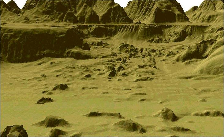
The Lake Tahoe basin was formed between 2 and 3 million
years ago. Thousands of years ago there was an avalanche, the remnants
of which we can be seen in the left-hand graphic image shown below, where
boulders are strewn across the lake floor.
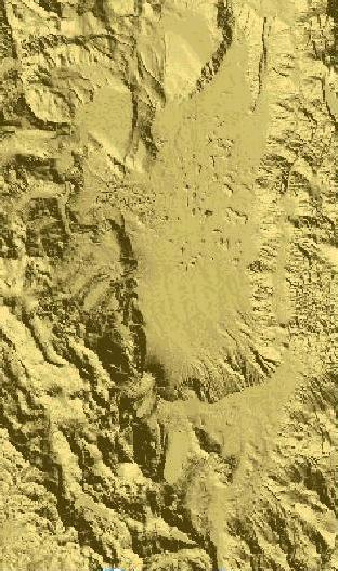
The Lake Tahoe STF source data represents a 10-meter
digital elevation model (DEM) over a 32 km by 83 km area.
.
 _
_
_
_ 
.
Recognizing the unique nature
of Lake Tahoe, President Clinton issued an executive order in July 1997
to establish a formal interagency partnership for management of Federal
activities with the Lake Tahoe Basin and development of a linked natural-resources
database and a Geographic Information System (GIS).
The source data for this project
was downloaded from the resulting Lake
Tahoe Clearinghouse. A unique 10 meter terrain/bathymetric surface
has been generated integrating data from:
- 10 meter DEM derived from
1:24,000 USGS Quad Map contours
- State-of-the-art USGS Marine
Geology multi-beam sonar
- State-of-the-art airborne
SHOALS lidar operated by the Corps of Engineers
Feature data have been assembled
from 1:24,000 source Digital Line Graphics. Digital Orthophoto Mosaic has
been assembled from 72 Digital Orthophoto Quads (DOQ) -- approximately
3 GB uncompressed.
Both gridded and polygonal data sets are provided
in the download.
DATA CONTENT
.
Gridded Data
AUTM Database Extents:
- Lower left corner: (736889.25, 4278544.50)
- Upper right corner: (772059.0625, 4362843.00)
- Minimum elevation value: 0.00 (meters)
- Maximum elevation value: 0.00 (meters)
.DRM Classes Used:
- Absolute Time
- Absolute Time Interval
- Access
- Areal Feature
- Citation
- Classification Data
- Classification Related Features
- Data Quality
- Description
- Environment Root
- Environmental Domain Summary
- Feature Edge
- Feature Face
- Feature Face Ring
- Feature Node
- Keywords
|
- Linear Feature
- Perimeter Data
- Perimeter Related Feature Topology
- Process Step
- Property Grid
- Property Grid Hook Point
- Regular Axis
- Responsible Party
- Spatial Extent
- Table Property Description
- TM Augmented 3D Location
- Transmittal Root
- Transmittal Summary
- Union Of Feature Topology
- Union Of Features
- Union Of Geometry Hierarchy
- ..
|
EDCS Classification Codes Present:
- ECC_BUILDING
- ECC_FOREST
- ECC_LAKE
- ECC_LAND
- ECC_OBJECT
- ECC_ROAD
- ECC_SPOT_ELEVATION
- ECC_TREED_TRACT
.
Polygonal Data
Polygons: 2034846
Area: 2656 km2
AUTM Database Extents:
- Lower left corner: (739000.00, 4299496.00)
- Upper right corner: (769500.00, 4350000.00)
- Minimum elevation value: -999900.00 (meters)
- Maximum elevation value: 10890.00 (meters)
DRM Classes Used:
- Absolute Time
- Absolute Time Interval
- Access
- Ambient Colour
- Areal Feature
- Attribute Set
- Attribute Set Index
- Attribute Set Table
- Attribute Set Table Group
- Attribute Set Table Library
- Citation
- Classification Data
- Classification Related Features
- Classification Related Geometry
- Colour Shininess
- Data Quality
- Description
- Diffuse Colour
- Emissive Colour
- Environment Root
- Environmental Domain Summary
- Feature Edge
- Feature Face
- Feature Face Ring
- Feature Node
- Image
- Image Library
- Image Mapping Function
- Inline Colour
|
- Keywords
- Linear Feature
- Perimeter Data
- Perimeter Related Feature Topology
- Polygon
- Presentation Domain
- Primitive Colour
- Process Step
- Property Value
- Responsible Party
- RGB Colour
- Reference Vector
- Rendering Properties
- Spatial Extent
- Spatial Index Data
- Spatial Index Related Geometry
- Specular Colour
- Texture Coordinate
- TM Augmented 3D Location
- Translucency
- Transmittal Root
- Transmittal Summary
- Union Of Feature Topology
- Union Of Features
- Union Of Geometry Hierarchy
- Union Of Primitive Geometry
- Vertex
- ..
|
EDCS Classification Codes Present:
- ECC_BUILDING
- ECC_BUILT_UP_REGION
- ECC_DRY_LAND
- ECC_FOREST
- ECC_LAKE
- ECC_LAND
- ECC_ROAD
COMPATIBILITY INFORMATION
This data set is compliant with SEDRIS 4.0.x.
POINT OF CONTACT
Send email to [email protected] for questions or assistance in using this data
set.
As a minimum, please provide the following in your
email:
- data set name
- SEDRIS compatibility version
- hardware architecture
- OS name and version
- detailed problem description
DOWNLOAD
- FILE
|
- SIZE
|
- tahoe_4.0.zip
|
- 266M
|
|
Last updated:
_ April 13, 2008
|